Pakistan

Himalaya Karakoram Travel in Pakistan

I am text block. Click edit button to change this text. Lorem ipsum dolor sit amet, consectetur adipiscing elit. Ut elit tellus, luctus nec ullamcorper mattis, pulvinar dapibus leo. I am text block. Click edit button to change this text. Lorem ipsum dolor sit amet, consectetur adipiscing elit. Ut elit tellus, luctus nec ullamcorper mattis, pulvinar dapibus leo. I am text block. Click edit button to change this text. Lorem ipsum dolor sit amet, consectetur adipiscing elit. Ut elit tellus, luctus nec ullamcorper mattis, pulvinar dapibus leo.

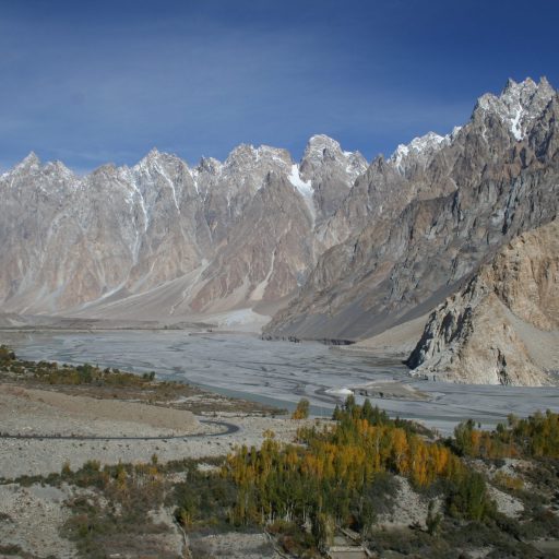
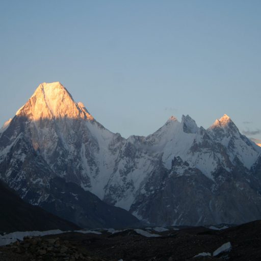
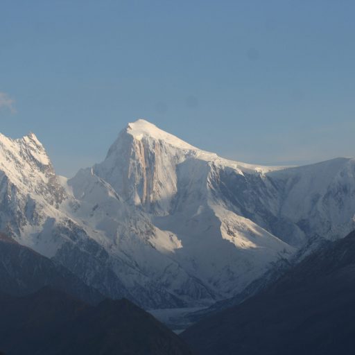
The 'Passu Cones' or 'Passu Cathedral', lies to the north of the Gulmit village in Gojal Valley along the Karakoram Highway.

Gilgit, Baltistan and Hunza

I am promo text. Click edit button to change this text. Lorem ipsum dolor sit amet, consectetur adipiscing elit. Ut elit tellus, luctus nec ullamcorper mattis, pulvinar dapibus leo.
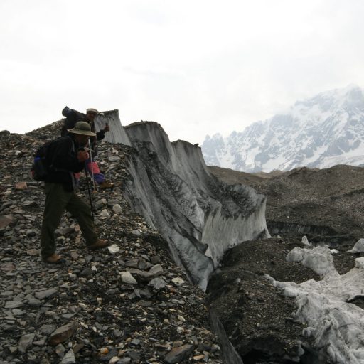
On the Baltoro Glacier

Trekking

Gilgit Baltistan, formerly known as the Northern Ares, offer the best trekking and climbing in the world. We are offering the following treks:

Concordia K2 Base Camp Trek

K2 Base Camp Gondogoro La Trek

Nanga Parbat Circuit Trek

Nanga Parbat Fairy Meadows Trek

Batura Glacier Trek

Upper Tirich Mir Glacier Trek

Biafo Glacier via Jamal Pass Trek

Haramosh Pass Trek

Snow Lake Hisper Pass Trek


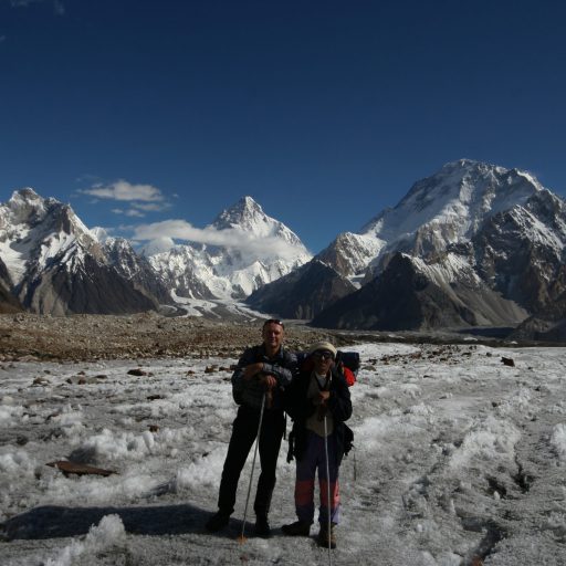
Concordia on the way to K2 Base Camp

Concordia K2 Base Camp Trek

The Karakoram Range contains four mountains above 8000m and scores above 7000m. These peaks dominate the upper end of enormous valleys and some of the largest glaciers on earth. Concordia is the meeting point of such dramatic glaciers and valleys. The Baltoro and the Godwin Austin [K-2] glaciers join forces here to flow for dozens of miles along the Braldo valley, carving an incredible landscape out of bare granite. Leaving the village of Askole, we will walk along a corridor of high, sharp peaks sandwiched between the Masherbrum and the Altoro Muztag to reach the “Throne Room of the Gods”, from where K2, Broad Peak, Gasherbrum IV, and many other peaks above 7000m are in full view. Weather and time permitting, side-trips to K2 and/or Broad Peak base camps can be enjoyed on this trek. This spectacular journey is perhaps the most popular of all routes amongst trekkers and is ideally suited to experienced and fit trekkers. K2 and Broad Peak are also accessible via the Gondogoro Pass from the Hushe Valley and Masherbrum region to the south. This alternate route is equally as strenuous and scenic, providing trekkers the opportunity to experience the seldom-visited eastern slopes of the former kingdom of Baltistan and discover the beauty of the south side of the Karakoram Range.

On the way to Ali Camp

K2 Base Camp Gondogoro La Trek

The K-2 Base camp Gondogoro la trek gives one of the greatest and loveliest mountain panoramas on earth. In a small area, there are four peaks above 8000 meters nestled beside hundreds of peaks of varying altitude and beauty. The scenery here truly cannot be matched anywhere else in the world. By a spectacular flight or drive along the KKH from Islamabad we will reach Skardu from where a seven hours jeep drive takes us to Askoli and for two weeks onward trek over the panoramic Gondogoro La (5500m) to Hushe village. Optional rest days at Concordia, the meeting point of the Baltoro and Goodwin Austin Glaciers. It will take us in close contact with great peaks including K-2, Broad Peak Gasherbrum II & I. The climax of the trek is the crossing of the Gondogoro La to enter the Hushe valley to take the return road journey to Islamabad. With the logistic support of Balti porters, the trek becomes a mixture of nature and cultural splendor.

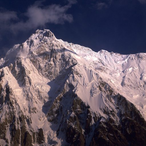
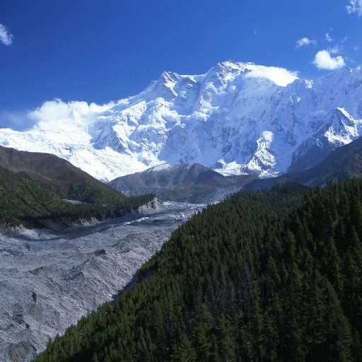
Nanga Parbat seen from Rupal Valley

Nanga Parbat Circuit Fairy Meadows Trek

Nanga Parbat, the westernmost pillar of the Himalayas, could easily be considered a range in itself for it spans nearly 40 km with uninterrupted ridges. The base is wrapped with thick pine forest and surrounded by meadows of colourful alpine flora and fauna. Nanga Parbat reaches 8100 metres and overshadows the Deosai Plateau, a grassy plateau dotted with rolling hills at an impressive 4300 metres. The landscape in this area is nearly all alpine, with small lakes dotting the valleys and huge glaciers working their way down into the woods. The high pastures in this region are used by shepherds and their flocks, which graze around the giant mass of Nanga Parbat. The northeast face of Nanga Parbat is a dramatic vertical wall soaring 4500m high. For the adventurous trekker seeking impressive views, this optional route climbs though the Mazeno Pass and into the Diamir Valley to the south.

Batura Glacier Trek

The former mountain kingdom of Hunza and Nagar, in the Gilgit-Baltistan Region, bordering China, are relatively recent additions to the Pakistan map. A beautiful land scattered with lush apricot orchids, surrounded by snow-capped peaks towering above 7000m, and set amidst some of the world’s largest glaciers, make for an impressive and colorful display. The upper Hunza Gojal valley area is home to the 56 km long Batura glacier. This popular trek is accessible from the Karakorum Highway and reaches a maximum elevation of 4000m, making it the ideal trek for novice trekkers and those wishing to take advantage of spring or autumn temperatures.

Upper Tirich Mir Glacier Trek

Trek in the remote mountains of the Hindu Kush and try the delicious mulberries and walnuts of the friendly people living in the isolated Kalasha Valleys. Just a few miles from the north-western border of Pakistan with Afghanistan lies Tirich Mir (7700m), the highest mountain in the Hindu Kush range. Accessibility to the area is limited to weather-permitting flights via Peshawar to Chitral or by jeep from either Gilgit or Swat (closed in winter). Despite receiving relatively few visitors, the isolated tribes and peoples of these northern valleys (believed to be Indo-Aryan descendants from the 2nd millennium BC) are at once warm and hospitable. This area offers superb trekking, undeveloped natural beauty and a fascinating glimpse of diverse ethnic, cultural and religious harmony in a region scarcely affected by the modern age. The trek to the Upper Tirich Mir Glacier ascends to an altitude of 4700m and boasts incredible views of numerous glaciers and peaks in the Hindu Kush extending west to Afghanistan and north to the Pamirs of Tajikistan.

Biafo Glacier via Jamal Pass Trek

This new route via Jamal Pass (5265m) leads to the Snow Lake and Biafo Glaciers. The pass has been named by Baqir Jamal. A local team opened up this new route from Hoo Valley behind Apo Aligon. This is a technical pass and requires the use of fixed ropes on the descend, where it becomes very steep. Approaching Snow Lake following a broad highway of Ice, a huge glaciated basin at 4500 meters, there will be a couple of crevasse areas where it will be necessary to rope up. Here we have the opportunity to view Biantha Brak, (7284 m), Snow Lake peak and Simkiang glacier and from the Jamal pass beautiful view of K2.

Haramosh Pass Trek

The Haramosh area is rarely visited by tourists. However, trekking trips and expeditions to nearby peaks can be organized with ease. The region is rich in mineral resources and pine forests. On the trek, we can see green meadows, Kutwal Lake (3260m), Haramosh Peak (7397m) and the surrounding peaks of Malubiting (7453m) and Laila (6986m).

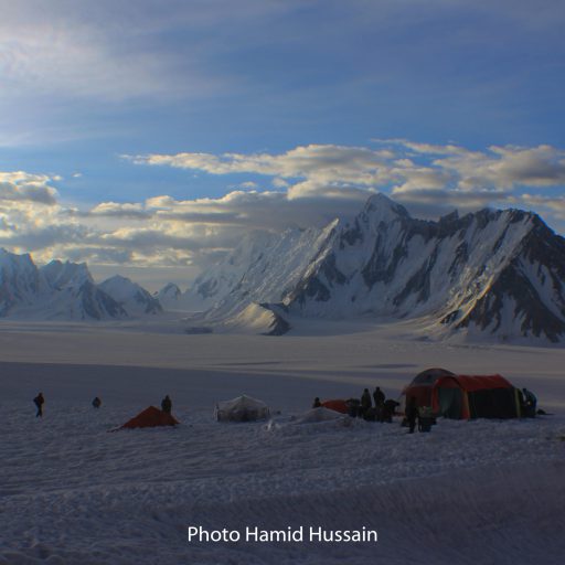
On the Snow Lake Trek / Photo Hamid Hussain, Skardu, Pakistan

Snow Lake Hispar Pass Trek

“Snow Lake and The Finest Mountain Scenery in the World” (Francis Younghusband)

“Beyond all comparison the finest view of mountains it has been my lot to behold,” Sir Martin Conway, the first European to cross the Hispar Pass, speaking of Snow Lake.

116 km glacier area, which is the largest continuous glacial system outside of the polar icecaps. It is arguably the most challenging and rewarding area in the Karakorum for trekkers and mountaineers. Biafo Glacier (60 km. long) and Hispar Glacier (61 km. long) meet at the 5151 m. Hispar Pass to form one of the longest glacial systems outside the polar regions. This highway of ice connects two ancient mountain kingdoms; Nagar in the west with Baltistan in the east. At the base of Hispar Pass on its eastern flank rests Snow Lake, a basin of ice (16 km. wide) surrounded by granite pinnacles yet to be climbed. Glaciologists have conducted various experiments on the lake and have found the ice to be approximately 1.6 km. deep. Some go as far as to say that Snow Lake represents the last of the original ice cap in the earth’s temperate zones.

Broad Peak Base Camp

Expeditions

I am promo text. Click edit button to change this text. Lorem ipsum dolor sit amet, consectetur adipiscing elit. Ut elit tellus, luctus nec ullamcorper mattis, pulvinar dapibus leo.
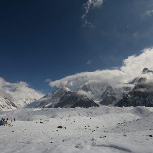
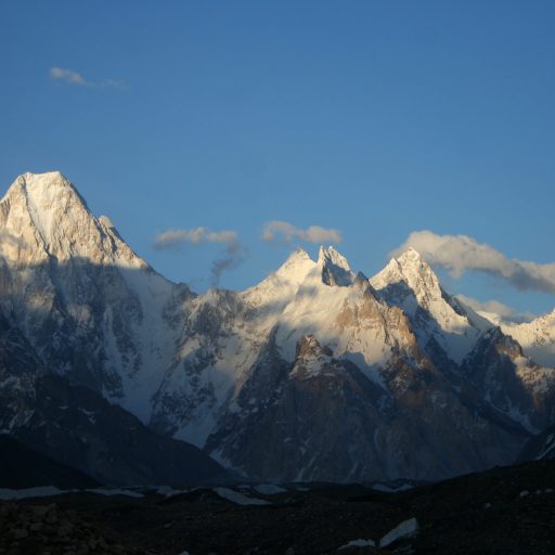
Gasherbrum II behind G IV

Gasherbrum II Expedition

The lowest, by a small footage, of the Karakoram 8000m peaks, is Gasherbrum II (8035m). Climbers have described it as an impressive but achievable peak, much like Cho Oyu in this respect, but with a walk to its BC that is said to be the best trek in the world. Its climb provides a perfect mountaineering experience. G2 stands in the majestic neighborhood of K2 in a close line-up of the world’s highest peaks in the titanic amphitheater of Concordia that has no parallel in the world. The snow-face of the South-West Ridge presents considerable difficulties on ice and snow mixed faces and ridges once you are above the plateau, after negotiating the heavily crevassed Gasherbrum Glacier. It is a steep way up at some sections. From above the snowy Banana Ridge you continue climbing on a series of ridges and reach a platform where camp 2 is generally set up. From here you climb a couple of ice pitches and then up the face going steeper before you reach the shoulder, the site of C3 at 7490m. After three pitches from there it is a diagonal way across the face from where a traverse leads to the base of the summit pyramid on the East Ridge. The climb from there is straight on a wide-open expanse with glorious surroundings but a few steep sections before you reach the narrow summit ridge.

Nanga Parbat from Fairy Meadows

Nanga Parbat Expedition

Nanga Parbat, Sanskrit for “Naked Mountain” is so named because some of its slopes are so steep that they are bereft of vegetation and snow. According to the local old legend, Nanga Parbat is also called Diamir, which means abode of fairies. It is believed that the Queen of fairies lives there in a castle made of solidice crystal, guarded by gigantic snow serpent and frogs. The earlier disasters in climbing this mountain are attributed to the displeasure of fairies. Nanga Parbat is not a single peak but consists of a 20km long series of peaks and ridges culminating in an ice crest of (8125m). Its South Face known as Rupal Face is (5000m) high, while the North or Raikot Face plunging over 7000m from the summit to the Indus, forms one of the world’s deepest gorge. This expedition takes us to the West Side, which is known as Diamir Face.

Nanga Parbat is the second highest mountain of Pakistan and ninth highest in the world. It is not part of the Karakoram as it is the western extremity of the mighty Himalaya. It is separated from the Karakoram by the mighty Indus River. Since the first disastrous British expedition led by A. F. Mummery in 1895, mountaineers have tried to ascend its summit through different routes but few lucky ones have succeeded. In 1934 four German climbers and six porters perished in a storm. In 1937 disaster 18 Sherpas and 12 climbers were buried alive by avalanche that covered their camp. In fact, Nanga Parbat has claimed more lives than any other 8000er relative to the number of attempts, hence the frightening nickname of Killer Mountain. It was first climbed in 1953 by a joint Austrian – German Expedition. Hermann Buhl made the final ascent in a tortuous 41 hours solo ordeal without oxygen. Italian mountaineer Reinhold Messner climbed the south face (Rupal Face) with his brother Günther in 1970, descending by the Diamir face, where Günther lost his life.

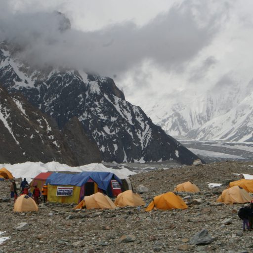
Camp on Broad Peak.

Broad Peak Expedition

The Broad peak is the 3rd highest peak in the Karakoram Range and the 4th highest in Pakistan. The peak is located on the west end of the Baltoro glacier. Despite of its massive height of 8,047 meters (26, 400 feet ) the peak remained escaped from the serious attention of the mountaineers for long period. According to the survey record of Pakistan it is mentioned as PK 23/52 A Broad Peak. Because of its broad top the locals named it ‘Falchan Brak’ means Broad Peak. This beautiful mountain of Pakistan repulsed scores of expeditions from various countries of the world. It was, however, scaled for the first time on June 9, 1957, by the Austrian Karakoram Expedition.

Gasherbrum I, II and IV seen from Concordia

Gasherbrum I Expedition

Gasherbrum I is popularly known as Hidden Peak. The clusters of peaks in the South East of the mighty K2 are named as Gasherbrum peaks. Swiss Skier “Sylvan Saudan” set the world record by skiing down from the summit. In local language Gasherbrum means “Shining Wall”.

The approach route to Base camp starts from Skardu through Shigar Valley and the approach trek starts from Thongal or Askole along the Baltoro glacier, southern Abruzzi glaciers.

Spantik

Spantik Expedition

Spantik was first climbed in 1955 by Karl Kramer’s German expedition. The most commonly climbed line follows the south east ridge, which was attempted by the Bullock Workman party in 1906. The ridge rises 2700 metres over a lateral distance of 7.6 km, at angles which are mostly less than 30 degrees, with a few sections up to 40 degrees. It contains varied terrain, from rocky outcrops to snow and ice and scree.

The mountain is very popular with organised commercial expeditions, due to its relative ease of ascent and scarcity of objective dangers. The short 3 day approach trek across straightforward terrain also provides for easy access and gradual acclimatization. This peak was scaled by Aus-Pak expedition in July 2011 led by a team of mountaineers from Army High Altitude School Rattu. Lt Col Abdul Aziz was supervising the team of Climbers.The peak can be approached from Nagar Valley as well as from Baltistan. The First expedition was held in 1988, the team composed of six Pakistan Army Personnel together with a German Team. The first Pakistani who reached the summit was Captain (now Brigadier) Muhammad Moiz Uddin Uppal.

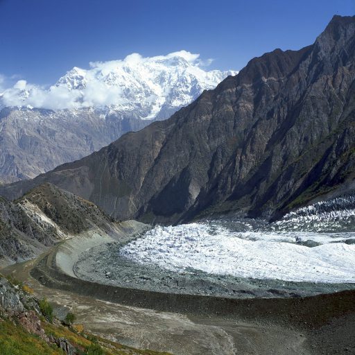
Glacier near Rakaposhi Base Camp

Rakaposhi Expedition

Rakaposhi  is a mountain in the Karakoram mountain range in Pakistan. It is situated in the middle of Nagar Valley, Nagar District and Danyore and Bagrote valley, approximately 100 km north of the capital city Gilgit of the Gilgit–Baltistan province. Rakaposhi means “Snow Covered” in the local language. Rakaposhi is also known as Dumani (“Mother of Mist”). It is ranked as the 27th highest peak in the world and the 12th highest in Pakistan, but it is more popular for its beauty than its rank might suggest. Rakaposhi has an uninterrupted vertical rise of approximately 6000 m (19,685 feet), making it the tallest mountain on land when measured from the base to peak.

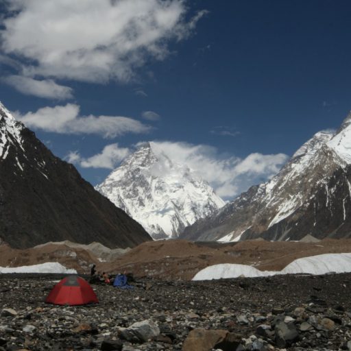
K2 seen from Concordia

K2 Expedition

Karakoram in Turkish means “Black Rubble”. In 1856 a British officer, Capt. Montgomery, surveyed a number of peaks in the Baltoro region of the Karakoram from a distance of about 200km. He noted a cluster of high peaks and named them K1, K2, K3 up to K37 using the prefix “K” from Karakoram.

In 1861 the area was further surveyed by Col. Godwin Austin who recognised K2 as the highest peak of the range and measured it to be 8619m—only three meters more than its official height (1988) of 8616m. Its local name is Chogori, which means Great Mountain.

Thus, K2, the second highest mountain in the world towers majestically above Concordia with the sweeping Godwin Austin Glacier offering an ice highway towards it. It was first climbed by Italians in 1954. The route to K2 goes through the Baltoro region of Baltistan. Only the highest or more prominent peaks of the region have been named or climbed. An incredible nineteen of these peaks tower over 7600m while four of them are 8000m.

Masherbrum

Masherbrum Expedition

Masherbrum is the 22nd highest peak on earth and the 11th tallest in our country with a eminence of around 2450m. It is situated in the Hushe district Ganche, Baltistan, which is home to most of the tallest peaks in the Karakorum range of Pakistan. Masherbrum is with 7821m the highest of the Masherbrum range, that is a sub-range of the Karakorum which is including Chogolisa with 7665m and K6 that stands tall at 7281m.

Masherbrum was first observed by the military of the subcontinent by Thomas Montgomerie in 1856  who indicated it as the tallest in the range as K1, though Masherbrum is rarely addressed as K1 today. The massif of the peak comprises of 2 main summits. The North summit or the main summit stands at 7821m and the South West with 7806m. These two summits have been climbed whereas the main peak was initially scaled by Willi Unsoeld and George Bell who were part of an American expedition in 1960. The expedition preferred the south west route at that time.

error: Content is protected !!